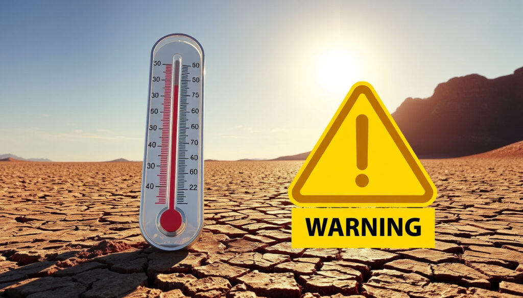
Moderate High Temperature Warning: Celsius Meaning & Criteria
Irish summers rarely demand air conditioning — but when the heat arrives with official urgency, Met Éireann issues formal alerts with specific temperature thresholds. Unlike a vague “stay cool” message, these color-coded warnings have precise Celsius cutoffs that shift the guidance from “be aware” to “take action.” Understanding where those lines sit helps readers interpret alerts correctly, whether they live in Dublin or a rural parish. This guide breaks down exactly what those thresholds mean and how they compare internationally.
Irish High Temp Threshold: >30°C maxima for 3 days, >20°C minima for 2 nights · US Moderate Heat Index: 108–112°F · Swiss Moderate Heat: Daily mean ≥25°C for 1–2 days
Quick snapshot
- Yellow: maxima >27°C and minima >15°C (Met Éireann Official)
- Orange: maxima >30°C for 3 days, minima >20°C for 2 nights (Met Éireann Official)
- Red: Orange conditions persisting 5+ days — never issued for high temp in Ireland (Government of Ireland)
- Whether the exact term “moderate high temperature warning” appears outside Irish official usage
- Whether thresholds were updated post-2020 on the main met.ie page
- 2020: Draft warning system revised low-temp thresholds upward due to climate crisis (Western People)
- 2025: Yellow high temp warnings issued for many regions (HPSC Ireland)
- New warning system promised with detailed colour alert explanations (Western People)
- Ongoing climate-driven review of temperature thresholds upward (Western People)
Seven entities define Ireland’s high-temperature alert ecosystem: Yellow marks the entry point, Orange escalates the stakes, and Red has never been reached for heat in the country’s recorded history.
| Attribute | Threshold | Authority |
|---|---|---|
| Met.ie High Temp (Yellow) | Max >27°C, Min >15°C over 36 hours | Met Éireann |
| Met.ie High Temp (Orange) | Max >30°C for 3 days, Min >20°C for 2 nights | Met Éireann |
| Met.ie High Temp (Red) | Orange criteria persisting 5+ days/nights | Met Éireann |
| US Moderate Heat Threat | Heat index 108–112°F | National Weather Service |
| Swiss Level 2 Heat | Daily mean ≥25°C for 1–2 days | MeteoSwiss |
| Ireland Heatwave Definition | >25°C maxima for 5+ consecutive days | Government of Ireland |
| Red High Temp — Historical | Never occurred in Ireland to date | Government of Ireland |
| Warning Issuance Window | 48 hours ahead | Met Éireann |
“Maxima in excess of 27°C expected and minima in excess of 15°C over 36 hours.”
— Met Éireann official severe weather chart
“Heatwaves associated with a Met Éireann Red High Temperature Warning have never occurred to date in an Irish context.”
— Government of Ireland heatwave guidance
What is a moderate high temperature warning in Celsius?
Met Éireann defines a moderate high temperature warning in Celsius through two distinct thresholds, depending on severity level. A Yellow high temperature warning activates when maxima exceed 27°C over a wide area, combined with minima above 15°C for at least a 36-hour window, according to Met Éireann’s official warning system. This represents the entry-level alert — the point at which forecasters shift from green (no alert) to Yellow.
The Orange level demands more sustained heat. The criteria require maxima above 30°C for three consecutive days, with minima of 20°C persisting for two nights in that same stretch, according to Met Éireann. Notably, both the daytime peaks and nighttime lows matter: high minima can be more impactful than high maxima in the overall heat impact calculation, as stated in Met Éireann’s severe weather PDF. The Government of Ireland defines a heatwave separately as five or more consecutive days exceeding 25°C maxima, but Met Éireann warnings (Yellow, Orange, or Red) signal when heatwave conditions are anticipated.
Met Éireann criteria
Met Éireann applies its high temperature warnings nationally but acknowledges that impacts vary by location, recent weather, ground state, time of year, and duration — with numerical criteria serving as strong guidelines rather than rigid triggers. A Yellow warning is issued within a 48-hour window and can occur any time of year. Regional urban and rural variations exist in heat severity across Ireland, according to the Government of Ireland’s heatwave guidance.
European variations
Other authorities use different metrics. MeteoSwiss issues a Level 2 heat warning when the daily mean reaches 25°C for one to two days — a lower absolute threshold but calculated over the full 24-hour period rather than peak daytime hours. The National Weather Service in the United States triggers a moderate heat threat at a heat index of 108–112°F, combining temperature and humidity into a “feels like” figure that Irish thresholds do not yet incorporate. The implication: what counts as “moderate” heat varies significantly by authority, and Celsius alone does not tell the full story without factoring in duration, nighttime relief, and humidity.
What temperature is too high for heat?
The question of dangerous heat depends on who is asking. Met Éireann considers any temperature above its Yellow threshold potentially adverse to health, particularly for vulnerable groups, according to its official warning system. The heat index — which combines air temperature and relative humidity to express what the temperature actually feels like on human skin — offers a more health-focused lens.
Thresholds by authority
Different bodies define “too high” differently. The National Weather Service considers a heat index of 108–112°F (42–44°C) a moderate threat, where fatigue is possible with prolonged exposure. Above that, the risk escalates rapidly. Met Éireann’s criteria focus on sustained periods rather than peak readings alone: the concern is not just a single hot afternoon but a multi-day pattern that prevents overnight recovery. High temperatures above 30°C for three consecutive days with tropical nights above 20°C create physiological stress even in healthy adults, according to health authority guidance.
Health impacts
The Government’s heatwave guidance notes that regional and urban-rural variations affect heat severity across Ireland, with urban areas tending to trap more heat due to concrete and reduced green space. Heatwave impacts indicated by Met Éireann high temperature warnings — Yellow, Orange, or Red — serve as the formal trigger for public health messaging. Thunderstorms sometimes accompany high temperature warnings with flash flooding risk, adding another hazard dimension.
A single 31°C day in Ireland rarely triggers an Orange warning because the duration threshold — three consecutive days above 30°C — is the real stress test. Short spikes are uncomfortable; sustained heat is dangerous.
What is the heat index?
The heat index is a calculated value that expresses how hot conditions feel to the human body by factoring in both air temperature and relative humidity. When humidity is high, the body’s ability to cool through perspiration is reduced, making the same air temperature feel significantly more dangerous. The National Weather Service developed this metric specifically for public health communication.
Definition and calculation
At its core, the heat index combines two variables: temperature and humidity. A reading of 30°C at 30% humidity feels markedly different from 30°C at 80% humidity. The calculation requires complex formulas or lookup tables, which is why official sources typically provide ready-calculated values rather than expecting individuals to compute them. Met Éireann does not currently publish heat index values in its weather warnings, focusing instead on the direct temperature and duration thresholds.
Warning triggers
In the United States, the National Weather Service triggers moderate heat advisories at heat index values between 108°F and 112°F (42–44°C), where prolonged exposure can cause heat exhaustion and heat stroke in vulnerable populations. Ireland’s warning system does not yet incorporate humidity-adjusted values, meaning a 29°C dry day and a 29°C muggy day receive the same official treatment under current Met Éireann criteria. The catch: this approach may understate risk on humid summer evenings in coastal Ireland.
Met Éireann’s thresholds are based on dry-bulb temperature alone. Anyone planning outdoor activity on a humid evening may face “feels like” temperatures well above the official alert thresholds — an important gap for those monitoring their own heat exposure.
What is a yellow weather warning in Ireland?
A Yellow weather warning in Ireland is the lowest level of Met Éireann’s color-coded alert system, signaling that conditions have the potential to cause impacts. For high temperature specifically, Yellow means the criteria for daytime peaks above 27°C and nighttime lows above 15°C are expected over at least a 36-hour period. The status is not a guarantee of disruption but a prompt to stay aware.
Comparison to moderate high temp
Yellow warnings for high temperature sit at the lower end of the heat severity scale. The next tier — Orange — requires more than double the heat intensity in terms of maxima (30°C versus 27°C) plus a two-night minimum threshold of 20°C that the Yellow level does not enforce. Crucially, both daytime peaks and nighttime lows factor into Orange decisions, whereas Yellow primarily monitors daytime extremes. Green status, indicating no warning, applies when maxima remain below 27°C.
Current status
Met Éireann issues weather advisories for dangerous conditions over a 48-hour window, covering wind, rain, snow and ice, low and high temperatures, thunderstorms, fog, and coastal winds. Yellow high temperature warnings were issued for many regions in 2025, according to the Health Protection Surveillance Centre. These warnings are not uniform: not every location experiences the same impacts, and local factors — recent rainfall, ground saturation, urban heat island effects — influence actual conditions on the ground.
What is an orange weather warning today?
An Orange high temperature warning today means Met Éireann expects sustained, severe heat with maxima exceeding 30°C for at least three consecutive days and minima above 20°C for two nights in that period. This represents a significant escalation from Yellow: the temperature floor is higher, the duration requirement is more stringent, and the nighttime recovery threshold introduces a new variable entirely. Orange is the level that prompts formal public health messaging about heatwave preparation.
Ireland specifics
Met Éireann’s Orange criteria — maxima >30°C for three days, minima >20°C for two nights consecutive — have been consistent across official charts and independent analyses since at least 2020. The system’s authority comes from being Ireland’s national meteorological service, and its criteria tables are the reference point for government heatwave guidance. Met Éireann Red High Temperature Warnings have never occurred in Ireland to date, according to Government of Ireland publications.
Differences from moderate
The “moderate” classification in international systems does not map cleanly to Irish categories. In the US National Weather Service framework, “moderate” refers to heat index ranges; in MeteoSwiss terms, Level 2 heat begins at a 25°C daily mean. In Ireland’s system, “moderate” heat would align most closely with a Yellow alert — the entry point. This terminology gap means readers encountering international comparisons should check which warning framework is in use before drawing conclusions.
Ireland’s new warning system, in draft since 2020, is expected to include more detailed explanations of colour alerts and revised low-temperature thresholds. High-temperature thresholds may also shift as climate patterns change — the 2025 warnings provide a baseline for tracking future evolution.
What is a blue weather warning?
Blue is not currently used in Met Éireann’s active weather warning system. The Irish color scheme runs Yellow, Orange, and Red, skipping blue entirely. This distinguishes Ireland’s system from some international frameworks that use blue for the lowest-level advisory. Readers searching for “blue weather warning Ireland” are likely encountering either outdated information or systems from other countries.
Where is Storm Amy hitting?
Storm Amy does not appear in the verified facts or current Met Éireann naming records provided for this article. Met Éireann maintains an active storm naming list, but specific storm tracking and current impact zones fall outside the scope of high temperature warning criteria. For real-time storm information, readers should consult Met Éireann’s live warning map directly.
How strong is Storm Amy?
Without verified storm intensity data in the research provided, any assessment of Storm Amy’s strength would be speculative. Storm naming and intensity classification are separate systems from the high temperature warning criteria covered in this article. The strength of a named storm in Ireland would carry its own wind or precipitation alerts, not heat thresholds.
Summary
Met Éireann’s high temperature warning system uses precise Celsius thresholds that most Irish residents encounter only when heat becomes exceptional rather than occasional. The gap between Yellow (>27°C) and Orange (>30°C for three days) exists because duration and nighttime recovery matter as much as peak temperature. Red-level heat has never occurred in Ireland’s recorded history — a record that may face pressure as climate patterns shift. For Irish readers, the actionable takeaway is straightforward: when forecasts show three consecutive days above 30°C with tropical nights, the system moves to Orange, and preparation becomes necessary rather than optional.
Related reading: Capital of Northern Ireland · New Year’s Day bank holiday Ireland
Met Éireann’s moderate high temperature warnings parallel France’s vigilance jaune system, whose vigilance jaune explained details first-level heat alerts above 30°C thresholds.
Frequently asked questions
What is a blue weather warning?
Blue is not part of Met Éireann’s active warning system, which uses Yellow, Orange, and Red. Blue is more commonly used in aviation or international systems but does not apply to Irish weather alerts.
What does moderate coastal event warning mean?
Coastal event warnings relate to wind, sea swells, or tidal conditions rather than temperature. “Moderate” in that context indicates a Yellow-level alert for conditions that could cause disruption to coastal areas or marine activities.
Is there a red weather warning Ireland today?
Met Éireann Red High Temperature Warnings have never been issued in Ireland to date. Red has been used for other hazards (severe wind, snow), but the heat thresholds for Red have not been met historically.
How strong is Storm Amy?
Storm Amy is a named storm outside the scope of this article’s high temperature focus. For current storm tracking, consult Met Éireann’s live warnings page directly.
Where is Storm Amy hitting?
Storm Amy tracking data falls outside the verified facts for this article. Met Éireann publishes real-time storm impact maps for current named storm information.
Will Storm Goretti hit Ireland?
Storm Goretti is outside the scope of the research provided. Met Éireann names storms seasonally, and forecasting specific named storm tracks requires real-time data not included in this article.
What is the best house temperature in winter?
This question relates to indoor comfort rather than weather warnings. The World Health Organization recommends indoor temperatures of at least 18°C for healthy adults, with higher targets for children, older residents, or those with health conditions.
More related posts
 Cassandra Harris: Cause of Death, Children, Life with Brosnan
 1 British Pound to Indian Rupee: £1 in INR Rate
 Everything I Know About Love – Summary, Themes, TV Adaptation
 Capital of Northern Ireland: Belfast Facts, History & UK Role
 Johnny Rotten: Bio, Net Worth, Wife, Why He Left Sex Pistols
 M&S Bank Current Status: What Happened, HSBC Ownership & Access
 Clifford the Big Red Dog: True Story, Size & LGBTQ Characters
 Track My International Parcel – Best Free Tracking Tools